LOCATIONS OF JUSTICE
Visit the Locations of Justice websiteLocations of Justice was a collaboration between the Center for Spatial Research and the Architectural League of New York. Its team included Laura Kurgan, Juan Francisco Saldarriaga and Jochen Hartmann
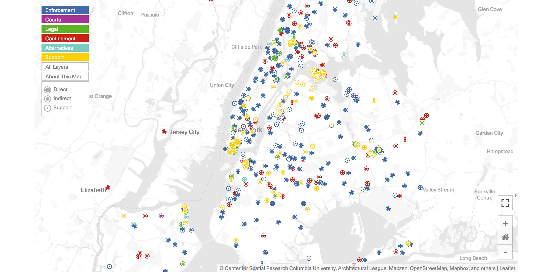
This interactive map charts the reach and locations of the institutions and agencies involved in New York City’s criminal justice system. By making an often stealthy decentralized cluster of institutions visible, this interactive map raises questions about the definition and pervasiveness of justice in the city.
Together, these institutions police the public, enforce laws, adjudicate charges, and confine, punish, rehabilitate, and supervise people who are found guilty of committing crimes. This map shows the distribution of actors and agencies within the fabric of the city. For those seeking to decode society’s relationship to crime and punishment, order and safety, the sites and spaces of the criminal justice system are a cipher. Read them as a receipt of public investment, a monument to collective notions of safety, or a footprint of government’s power in people’s lives. Some things, like police precincts, are scattershot throughout the city, omnipresent and everyday. Other things, like courts, are clustered in nodes where power is concentrated and authority proclaimed.