THE HAVEN PROJECT
Visit the Haven Project websiteThis project was developed at the Spatial Information Design Lab, in collaboration with New York Restoration Project. Its team included Laura Kurgan, and Juan Francisco Saldarriaga.
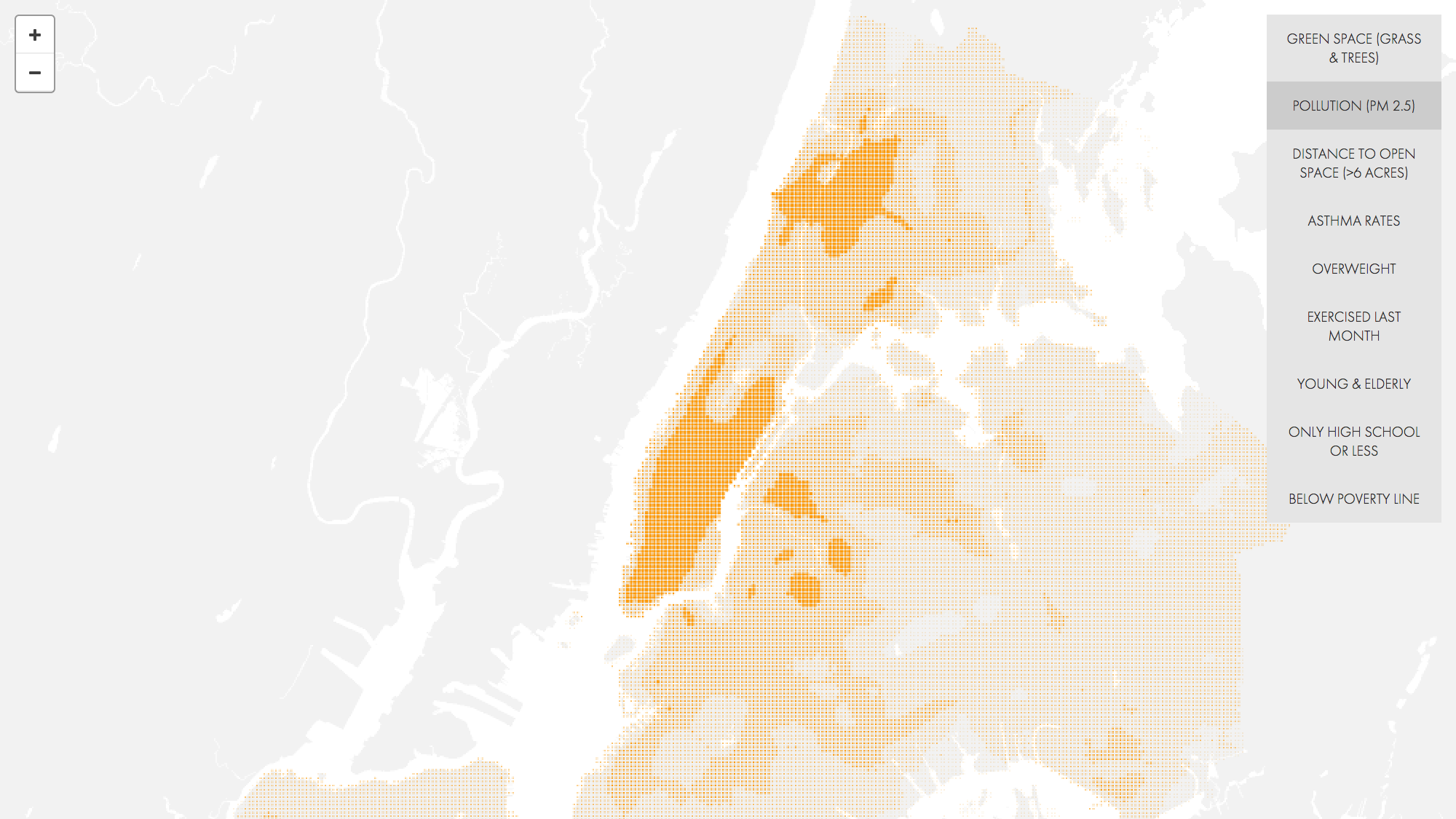
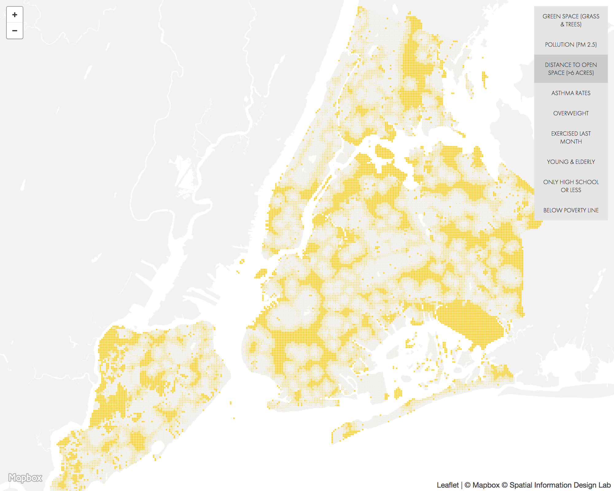
New York Restoration Project (NYRP) is developing a master plan to renovate a network of open spaces in Mott Haven and Port Morris in the South Bronx. Over the next several years, NYRP will fund the renovations and build them. The project aims to demonstrate measurable health and social outcomes resulting from an improved physical environment at the neighborhood scale. For example, one hypothesis is that by improving access to Randall’s Island, residents’ physical activity will increase with a correlative decrease in health care costs. As a first step, we will capture baseline health data and quality of life indicators which we will track as the project progresses. Through the maps and charts on this site we attempt to analyze and compare different parts of New York City according to specific health, demographic and environmental metrics.
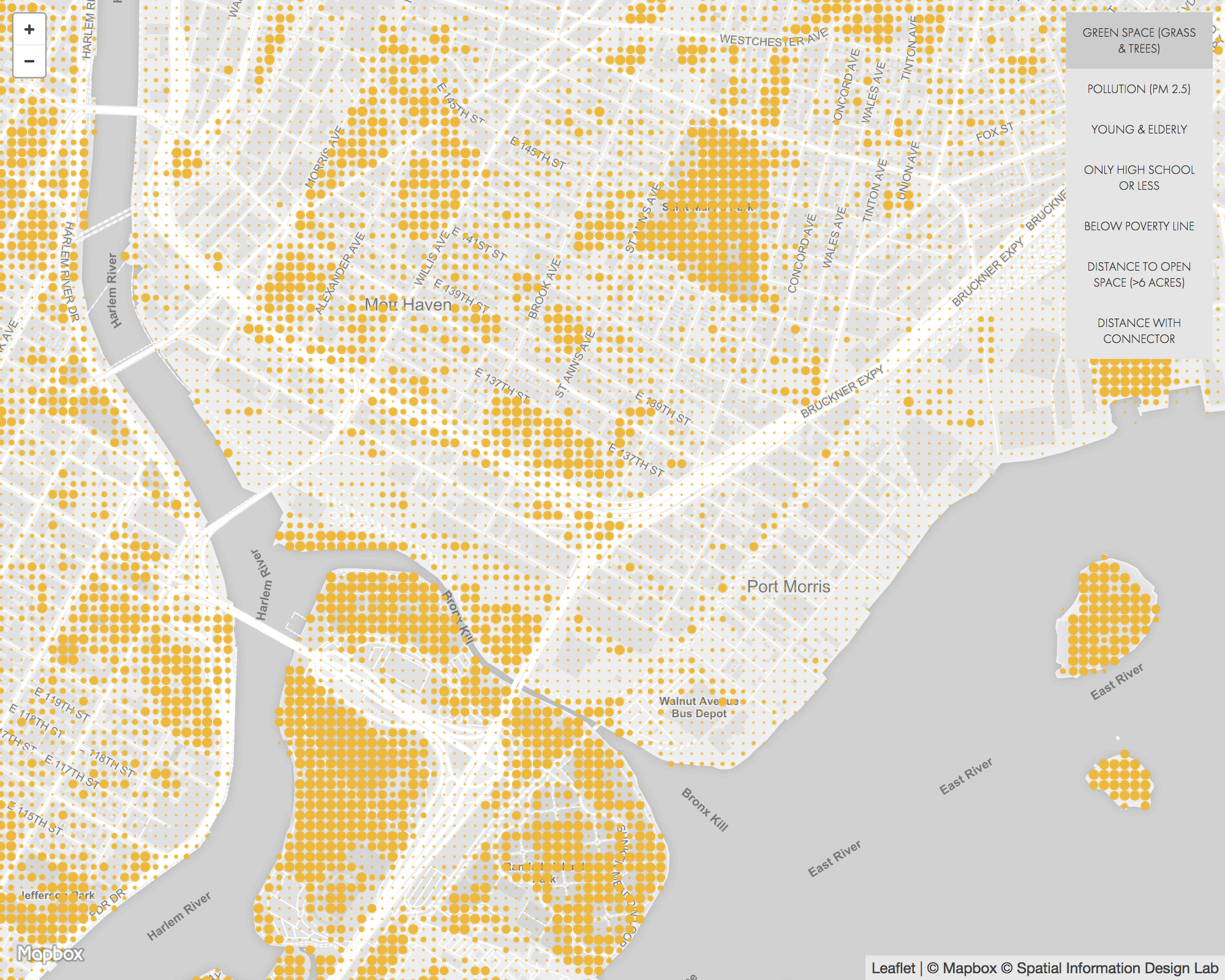
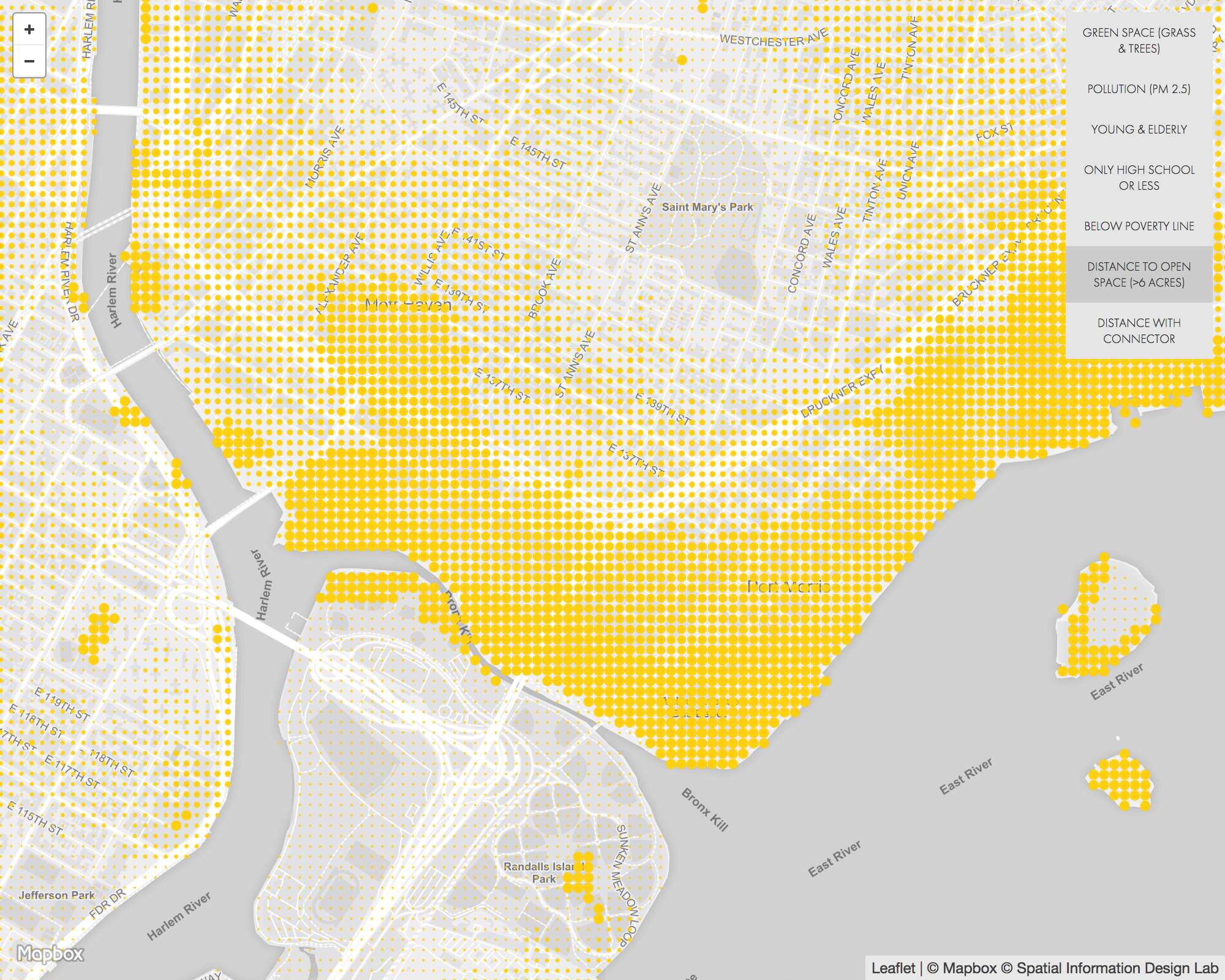
This detailed view of Mott Haven and Port Morris shows each environmental and demographic metric at a more detailed scale. In addition, you can see how implementing the Randall’s Island Connector - an NYCEDC project - will change the distance to open spaces metric for the neighborhood.
For more information about the current state of the project and to download the Master Plan, visit NYRP’s project page.